CASE STUDIES
For over three decades, Güralp has been at the forefront of seismic instrumentation, delivering precision-engineered solutions to the world's most demanding monitoring challenges. Our case studies showcase real-world deployments across earthquake early warning, nuclear treaty verification, civil infrastructure monitoring, and energy exploration.
From the harsh environments of Antarctic research stations to critical urban early-warning networks, these projects demonstrate the reliability, sensitivity, and durability that make Güralp the trusted choice for governments, academic institutions, and industry leaders worldwide.
NORSAR
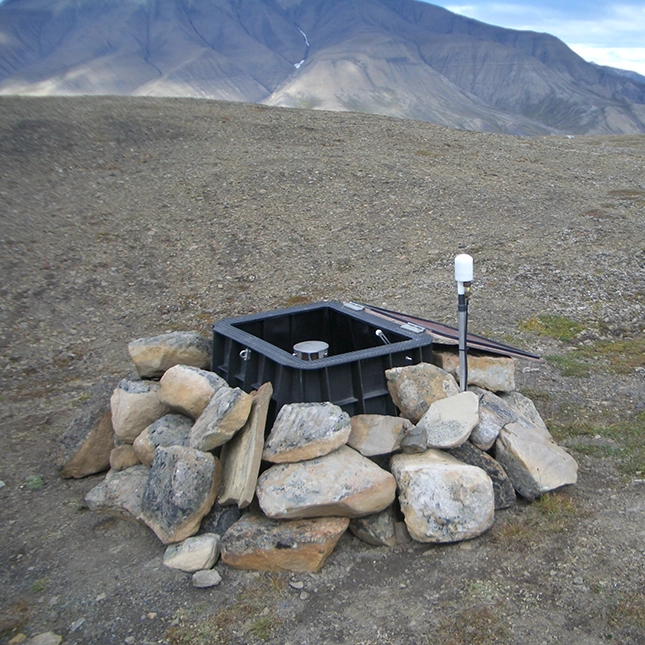
Güralp has partnered with NORSAR to supply seismic instrumentation for Norway's monitoring arrays, including those supporting the CTBT's International Monitoring System.
The collaboration has evolved from early deployments of 3ESP and 3T sensors to the joint development of bespoke hybrid instruments, and more recently to 3T-120 seismometers with Affinity digitisers for carbon storage baseline monitoring.
Today, Güralp instrumentation is deployed across more than 100 NORSAR stations, demonstrating a lasting partnership built on responsive engineering and technical innovation.
EEW In Southeast Asia
In Southeast Asia a national seismic monitoring and earthquake early warning capability has been upgraded with a comprehensive suite of Güralp instrumentation, including 106 broadband seismometers, 64 borehole systems, 128 accelerometers, and 169 digitisers. The project required low-noise borehole performance in urban areas, full coverage combining weak- and strong-motion sensors at each station, and mobile units for rapid aftershock deployment.
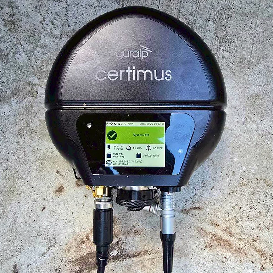
Güralp supplied observatory-grade 3T sensors, 3T5T borehole instruments, 3ESPC portable seismometers, Certis and Certimus medium-motion sensors, Fortis and Fortimus accelerometers, and Minimus+ and Affinity digitisers - all compatible with SeedLink and third-party analysis software. A 30-day on-site training programme supported by local distributor Asiamet ensured smooth deployment, with the final phase completed in early 2026.
The upgraded network now delivers higher-resolution data, faster public alerts, and improved monitoring coverage across the region's most seismically vulnerable areas.

Ambient Noise
The Abu Dhabi National Oil Company (ADNOC) commissioned a low-frequency passive seismic investigation using eleven arrays of Guralp broadband seismometers to determine the source of microtremor (1–6 Hz) and microseism (0.1–1 Hz) signals detected over hydrocarbon reservoirs in the region. The survey was conducted over a producing onshore oil field and a dry exploration well.
Analysis of the data revealed that the microtremor signals were strongly correlated with anthropogenic activity - stronger during the day and weaker at night - with the source traced to surface waves from a nearby motorway, while the microseism signals were attributed to ocean swell interactions from the Arabian Sea and Gulf. The study successfully demonstrated that the previously observed signals were not uniquely associated with hydrocarbon reservoirs but rather originated from surface waves propagating through shallow sediments.
Glasgow Geothermal
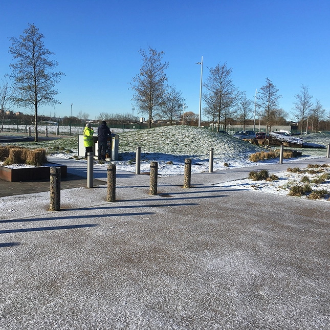
The British Geological Survey (BGS) has deployed five Güralp Radian broadband borehole sensors in a string configuration at the UKGEOS Glasgow Observatory to monitor the effects of mine water geothermal energy extraction from abandoned coal mines.
The project investigates the viability of using geothermally heated floodwater as a clean energy source for the UK's net zero target, and requires long-term seismic monitoring to discriminate between natural earthquakes and any potential induced seismicity.
The Radian instruments were selected for their wide dynamic range, 120s to 200Hz frequency response, and unique ±180∘ tilt tolerance, which allowed deployment at precise depths of 40m, 80m, 120m, 160m, and 198m despite borehole divergence from vertical.
The sensors stream real-time data to BGS, enabling analysis of local noise and seismic events to assess the environmental impact and safety of geothermal activities in the surrounding urban area.
Ohio Seismic Monitoring
The Ohio Department of Natural Resources has upgraded its statewide seismic network with Güralp instrumentation to lower the detection threshold to Magnitude 1, enabling better characterisation of seismic activity across the state.
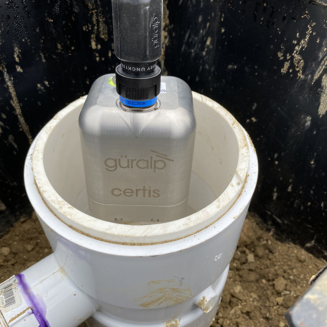
Initially transitioning from surface vaults with 6TD instruments to 10m posthole deployments using 40T sensors, the network has since adopted the Güralp Certis—an ultra-compact medium-motion seismometer that does not require levelling or orienting during deployment, significantly simplifying installation.
Since 2021, nine 40T and ten Certis sensors have been deployed with Minimus digitisers, with four additional Certis planned for 2025, using cost-effective PVC pipe posthole installations completed in just a few hours. The Certis stations have demonstrated superior performance, recording lower self-noise than the 6TD at long periods with tighter PSD banding, while the network exceeded its 80% data availability goal with 93% availability in 2023. According to OhioSeis Network Manager Jeffrey Fox, the Güralp instruments have ushered in a new era of research-grade seismic monitoring for the state.
SMART Cable
The InSEA SMART Cable wet demonstrator project, successfully deployed in December, 2023 represents a pioneering effort to integrate seismic and environmental sensors into standard telecommunication cable systems to enhance ocean-bottom monitoring while leveraging existing deployment methods for cost efficiency. The 21 km cable, deployed off the coast of Catania, Italy, was developed by Güralp in partnership with INGV and funded by the Italian Ministry of Research.
The system incorporates three instrumented repeater housings with Certimus broadband seismometers and Fortimus accelerometers, alongside external pods housing pressure and temperature sensors, all deployed using commercial cable-laying techniques.
Initial data from the system, validated against a nearby Güralp Orcus ocean bottom seismometer, shows high-quality seismic recordings for teleseismic, regional, and local events, demonstrating successful sensor coupling and operational effectiveness. The project has proven that such systems can be installed without compromising data quality, offering significant scientific value for earthquake and tsunami warning, and has generated growing global interest. INGV have expressed strong satisfaction with Güralp's collaboration and engineering support, paving the way for wider adoption of SMART cable systems worldwide.


Volcano Monitoring
The Te Maari crater monitoring project at New Zealand's Tongariro volcano demonstrated the effectiveness of rapidly deployable seismic arrays for capturing volcanic mass flow events, following heightened activity in mid-2012.
In July, GNS installed four Güralp 6T broadband sensors around the upper Te Maari vent, and despite the August 6th debris flow destroying one station (TON2), a replacement (TON7) was quickly deployed, ensuring continuous recording of both the initial debris flow and the subsequent October 13th lahar, which released ~50,000 m³ of water after a temporary dam broke.
The lightweight, portable 6T seismometers, chosen for their ease of installation with no mass clamping required, successfully recorded high-quality data at 100 Hz sampling, enabling researchers to apply an active seismic source method to analyze flow dynamics and location.
This case study highlights how temporary sensor arrays can be rapidly installed on active volcanoes to provide critical seismic data, offering a transferable template for lahar monitoring and mass flow analysis at volcanic sites worldwide.
Australia OBS
The 2014 deep-water seismic exploration project off northwest Australia, led by Geoscience Australia in partnership with major oil and gas companies, showcased the Guralp Liber ocean-bottom seismometer (OBS) as a powerful complement to traditional marine seismic surveys for sharp subsurface imaging. Deploying 20 Liber nodes equipped with 3-component 6T broadband sensors on the continental shelf at water depths exceeding 2,000 m, the array recorded airgun signals at very wide offsets over a 47-day period, capturing reflections and refractions from deep geological structures, including mid-crustal reflectors and the Moho discontinuity, which are typically poorly resolved by standard high-frequency streamer surveys.
The broadband instruments (0.0167–100 Hz) proved less susceptible to water-column multiples and delivered crisp seismic signals at offsets unattainable by conventional methods, enabling more accurate velocity models and improved depth migration.
Beyond active-source imaging, the Liber nodes offer additional value for passive seismic recording, including local seismicity and ambient noise, supporting cost-effective subsurface imaging and reservoir monitoring. As noted by Geoscience Australia's Alexy Goncharov, the data quality and coverage from this Australian National OBS Fleet are unmatched globally, highlighting the Liber OBS as an economical and highly effective add-on for hydrocarbon exploration and deep crustal studies.

Nepal Aftershock Study
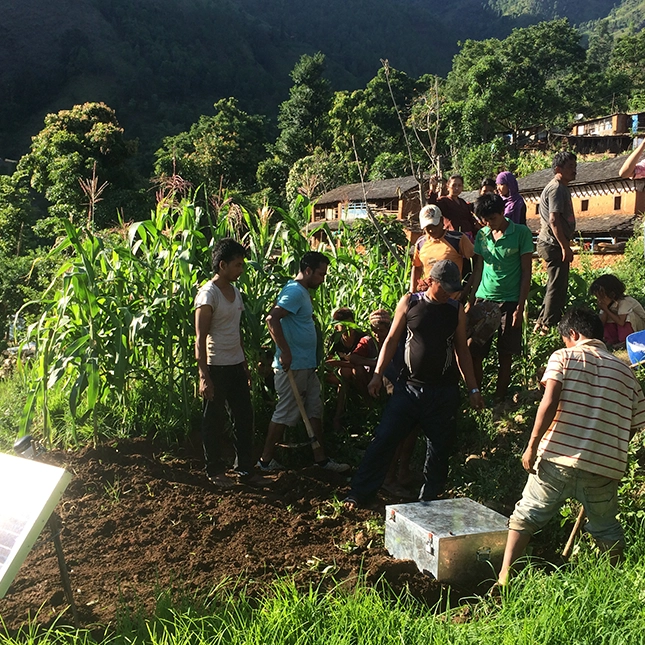
The NAMASTE Project, launched after the devastating April 2015 magnitude 7.8 earthquake in Nepal, deployed a 45-station seismic array to study aftershock seismicity and better understand the poorly characterized Main Himalayan Thrust fault, which poses a continuing seismic hazard to the region. Of these stations, 19 were Güralp broadband sensors, including 14 3T-120s (120s to 50 Hz) and 5 40Ts (60s to 50 Hz)—chosen for their rugged, portable, and waterproof IP68-rated designs, suitable for temporary deployments in challenging field conditions.
The array was arranged in a quasi-rectangular grid with ~15 km spacing across the rupture zone, with sensors installed in shallow vaults (0.8–1 m deep) on levelled tiles, insulated, and powered by car batteries and solar panels, recording continuously at 100 sps for 11 months from June 2015 to May 2016.
The high-quality data collected has been made available through the IRIS data management centre and continues to be analyzed by multiple international research institutions alongside Nepal's Department of Mines and Geology, contributing critical insights into earthquake initiation, rupture processes, and fault geometry that are essential for improving seismic hazard assessment in this densely populated Himalayan region.
Mexico Earley Warning
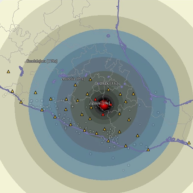
The Earthquake Early Warning (EEW) network for a major Mexican bank, developed in partnership with Güralp's distributor VASE Sismica and SeismicAI, aims to ensure business continuity and protect employees and customers across over 100 high-risk bank branches by providing rapid seismic alerts. To address Mexico's complex seismic sources, including subduction earthquakes along the Pacific coast and intraplate events, and variable soil amplification effects, the project deploys a dual-network strategy: a regional seismic monitoring network spanning central Mexico and western states, and local monitoring nodes equipped with Sanlien P-alerts that track site-specific ground motion.
Güralp supplied 50 Fortimus digital force-balance accelerometers, which combine the proven Fortis accelerometer with the low-latency Minimus digitiser, offering user-configurable gain settings and environmental health monitoring, housed in purpose-built surface boxes with solar-powered battery systems and PTP timing. Data from the regional stations is processed in the cloud using SeismicAI algorithms that continuously refine velocity models to optimize alert precision and minimize false positives, while the local nodes provide branch-level warnings. Once fully operational, the system is intended to deliver tens of seconds of advance warning before damaging shaking arrives, demonstrating how industry-driven EEW initiatives can simultaneously enhance safety for civilians and assets while contributing valuable data to the broader scientific community.

CO2 storage
The HNET project, led by Equinor in partnership with NORSAR, deployed the nine-element Holsnøy Array (HNAR) on the island of Holsnøy, offshore Norway, to establish baseline background seismicity monitoring prior to large-scale CO₂ storage commencing in the Horda Platform Region in 2024, addressing the risk of triggered seismicity from carbon injection activities. Güralp 3T-120 PH posthole seismometers, paired with Affinity digitisers were selected, due to their suitability for shallow subsurface installation in coastal environments, where they effectively mitigate ambient noise from ocean swell while maintaining noise levels close to the global average.
Arranged in two concentric rings with ~1 km aperture, the array significantly improved event detection capability for the offshore target area through beamforming and correlation techniques, lowering detection thresholds, providing initial event locations from back-azimuth and S-P wave arrival times, and enhancing overall location accuracy for small-magnitude events—including a detected ML 1.3 North Sea earthquake—that were previously undetectable by the existing Norwegian National Seismic Network.
By demonstrating that cost-effective land-based arrays can achieve lower detection thresholds for offshore monitoring, the HNAR project not only improves seismic hazard assessment for carbon storage but also enhances the economic viability of such projects, contributing critical data for understanding geological stability and designing effective monitoring strategies once injection operations commence.
High-Speed Rail Monitoring
The Korail high-speed rail monitoring project in Korea, established by the Korea Network Authority, deploys a comprehensive seismic network along 320 km of new railway line to support earthquake early warning and structural safety assessment.
The system comprises over 100 Güralp 5T tri-axial strong-motion accelerometers and 65 DM24 mk3 digitizers distributed across 34 stations, with each station typically featuring two accelerometers, one at the base of a supporting column and one at the top, to capture both ground motion and structural response.
The instruments are recessed into columns and concrete superstructures, secured with single fixing bolts, and connected via DCMs to the local TCP/IP network, enabling real-time data transmission through Scream! and GSMS protocols, which provide low-latency outputs including triggered data, peak ground acceleration (PGA), root mean square (RMS), cross-correlation, and spectral intensity (SI). This configuration not only delivers rapid alerts for seismic events but also allows operators to monitor structural integrity under both earthquake shaking and routine operational vibrations, contributing to regional seismicity knowledge while ensuring the safety and resilience of Korea's high-speed rail infrastructure.